 |
||
| Codale Tarn | ||
|---|---|---|
| Name Origin | Old English + Old Norse | |
| Type | Cirque tarn (glacial) | |
| Max. Length | 198 metres (650 feet) | |
| Max. Width | 99 metres (325 feet) | |
| Max. Depth | 7 metres (23 feet) | |
| Surface Area | 1.4 hectares (3.46 acres) | |
| Surface Elevation | 466 metres (1,530 feet) | |
| Access | Footpaths | |
| Topo Map | OL6 Explorer | |
| Coordinates | 54.469765 , -3.0865417 | |
| OS Grid Ref. | NY296088 | |
| what3words | invent.curry.enveloped | |
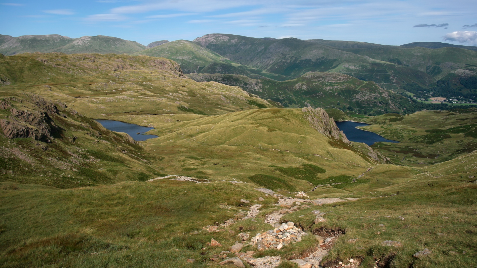
Codale Tarn is much smaller than its neighbour, Easedale Tarn, and the journey to reach much more arduous, but its location at the head of Easedale Valley, and its elevation of 466 metres (1,530 feet) above sea level, gives this tarn a sense of seclusion and isolation. It is a pretty tarn set in a hanging valley, created by ice action. Although this is a cirque tarn, it doesn’t bear all the typical features of one. It is moraine-dammed but to what extent is not fully understood.[1] It is deepest near the centre, and steepest at the north-west, falling around 3 metres in 7½ from its margin. It is shallowest in the southern margin falling only 3 metres in 200.[2]
Etymology
The word Codale, or at least the first element of it, would appear to be a little more challenging to decipher. It may be connected with Coledale, which in early modern times appears as Cow~.[3] The second element dale has roots in Old English dæl (valley, dale) and Old Norse dalr (valley, dale). Both of these words come from the reconstructed Proto-Germanic root word dalą. The word tarn, which has roots in Old Norse tjörn, means a small mountain lake, pond or pool.
Geography
To the north is Tarn Crag, with Lang Crag arcing round on the west, giving the appearance of a continuous ridge. To the east is Slapestone Edge, which drops off steeply to Easedale Tarn, and to the south is Belles Knott, a pyramid-shaped rocky prominence (as seen from the east), which offers excellent views all round.
This prominence is shaped so due to resisting the flow of ice as it moved eastwards from High Raise.[2] The moraine it left in its wake after the ice melted was the result of glacial melt-water trapped behind deposits of clay and rock, a natural dam blocking the most obvious outflow into the valley below. The current outlet is situated about one third of the way along the eastern edge, where Codale Beck, one of the sources that feeds Easedale Tarn, makes it way down the valley. The water that collects in this basin eventually makes its way into Grasmere via Sourmilk Gill and Easedale Beck. From the ridge of Blea Rigg, both Codale Tarn and Easedale Tarn can be seen, set against the backdrop of Grasmere Common and Helvellyn in the distance.
Jonathon Otley's A Concise Description of the English Lakes and Adjacent Mountains (1834) describes Codale Tarn as:
....a small piece of water containing a few trout, perch, and eels. It sends a small stream down a rocky channel into Easdale Tarn, which is one of the largest mountain tarns, seated in the western branch of Grasmere vale among rocky precipices, of which Blakerigg, or Blea Crag, is the principal. Its stream — from its frothy whiteness called Sourmilk Gill — is a striking object from the road.[4]
"Frothy whiteness", or words to that effect, was a phrase seemingly used often in these historic guide books to the Lake District. They portray a picture of something almost ethereal, a way to entice the reader to the charms of these highly-popular Victorian travel hotspots. Yet sometimes they will appear to gloss over some things entirely, or not mention them all at. Harriet Martineau's Complete Guide to the English Lakes (1855) and William Green's Tourist's New Guide (1819) do not even mention Codale Tarn; completely overlooked by the more popular and much easier to get to, Easedale Tarn.
The tarn sits in an elongated basin, almost equidistant between Easedale Tarn and Stickle Tarn. The dark water gives the impression of an abyss, however, this is not the case, being only a shallow 2 metres (6.5 feet) at its deepest. Aquatic plants such as sedge and water lobelia thrive in shallower tarns, and seem at home here,[5] as are trout and perch.[6]

References
- ↑ Smith, Alan (2014). The Smaller Lakes and Tarns of Lakeland. The Landscapes of Cumbria No.6. Keswick: Rigg Side Publications. p.34.
- ↑ 2.0 2.1 Cooper, W.H. (1960). The Tarns of Lakeland. London: Frederick Warne and Co. Ltd. p.174.
- ↑ Whaley, Diana (2006). A Dictionary of Lake District Place-Names. English Place-Name Society. School of English Studies, University of Nottingham. p.78.
- ↑ Otley, Jonathon (1834). Concise Description of the English Lakes. Fifth Edition. Keswick: Jonathon Otley. p.33.
- ↑ Blair, Don (2003). Exploring Lakeland Tarns: A Complete Guide. Revised Edition. Keswick: Lakeland Manor Press. p.95.
- ↑ Cooper (1960), p.175.